
Mary Sargent © 2006 …………….........……………….. click to enlarge
This is atypical of this section of Lenox Avenue. Note the pale green X. (Enlarge.)
See map.
Thursday, November 30, 2006
Central Harlem, Lenox Avenue Between 120th and 119th Streets
Posted by
Mary Sargent
at
8:08 PM
0
comments
![]()
Labels: Central Harlem, Lenox Avenue, Uptown
Wednesday, November 29, 2006
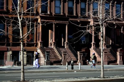
Central Harlem, Lenox Avenue Between 123rd and 122nd Streets
Mary Sargent © 2006 ………………………..........…….. click to enlarge
Now walking south on Lenox Avenue, co-named Malcolm X Boulevard. I'm calling it Lenox because it's an old Harlem street name, whereas 7th and 8th Avenues which were renamed, respectively, Adam Clayton, etc. and Frederick Douglass, were not names peculiar to Harlem.
Lenox Avenue is mostly residential, at least the section we walked between 125th and 116th, a broad avenue with a median divider and some handsome buildings. This block between 123rd and 122nd is featured in New York Architecture Walks, which includes a photograph of the building I'm showing you here, but they show the whole thing. The AIA (American Institute of Architects) Guide to New York City says "An intact blockfront of early brownstones. Imagine the whole neighborhood (both sides of the street) like this." Built in 1885-1886.
See map.
Posted by
Mary Sargent
at
8:10 PM
2
comments
![]()
Labels: Central Harlem, Lenox Avenue, Uptown
Tuesday, November 28, 2006
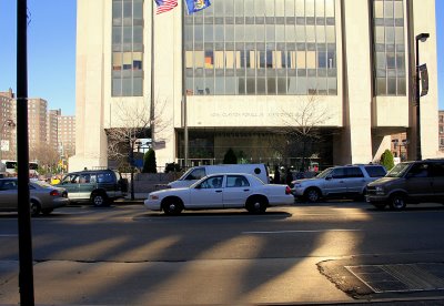
Central Harlem, 125th Street Between Adam Clayton Powell, Jr. Boulevard and Lenox Avenue
Mary Sargent © 2006 ……………….........…………….. click to enlarge
This is the Adam Clayton Powell, Jr. State Office Building. It was built in 1973 and named for Powell in 1983, and seems not to be well thought of by people interested in buildings and public spaces. See Project for Public Spaces' Hall of Shame, which explains Why It Doesn't Work. As for Powell himself, a prominent Harlem Congressman, he seems to be remembered now for his admirable early work, and the later corruption and resulting exclusion from Congress, and the final political defeat, all are as if they never happened. Shakespeare had it wrong in this case. (The evil that men do lives after them; The good is oft interred with their bones.) Oh happy Adam Clayton!
Now why am I showing this photo? I think it's the pointy shadows.
See map.
Posted by
Mary Sargent
at
7:56 PM
1 comments
![]()
Labels: 125th Street, Central Harlem, Harlem, Uptown
Monday, November 27, 2006
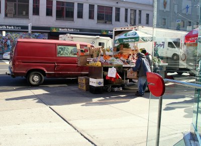
Central Harlem, Frederick Douglass Blvd Between 125th and 124th Streets
Mary Sargent © 2006 ……………….........…………….. click to enlarge
My son, Bill, came for a visit this Thanksgiving, and Friday we went for a walk in Harlem which is mostly new territory for me. In the 24 years I've lived here, I can remember going to Harlem only 4 times; once with a black man to eat at Sylvia's, which did not go over big, my being white, that is, but this was in the early 80s, maybe it's different now, once to go to some kind of African festival, a bit disappointing as it was in its early stages of organization, once to take my grandson to Rucker Park, so he could see the famous basketball court from his video game, and once to The Classical Theatre of Harlem to see Waiting For Godot. OH, I just remembered another time, another restaurant, but can't remember the name. Soul food.
Anyway, point is I have a lot of walking to do.
We took the A train to 125 and walked east to Lenox Avenue, down to 116 and up St. Nicholas back to 125. 125th Street is a big, bustling commercial street, with lots of stores and lots of people selling stuff on the sidewalk. It was a beautiful day in the 50s with bright, bright sun, but not so good for shooting because of the dark shadows and bright sunlight. Too much contrast. Especially a problem on 125th Street, so I can't show you the scenes I'm describing. Try to imagine.
This shot is taken from the corner of 125 and Frederick Douglass Boulevard, looking down the boulevard. By the way, Frederick Douglass is a continuation of Central Park West, which is a continuation of Eighth Avenue. Map Quest doesn't seem to recognize it.
See map.
Posted by
Mary Sargent
at
8:07 PM
2
comments
![]()
Labels: Central Harlem, Frederick Douglass Boulevard, Uptown
Sunday, November 26, 2006
West Village, West 4th Street Between Jones and Barrow Streets

Mary Sargent © 2006 …………………….........……….. click to enlarge
Maybe psychic shops look better at night. Or maybe they look better in the Village. See post of November 6.
Posted by
Mary Sargent
at
7:32 PM
0
comments
![]()
Labels: 4th Street, Downtown, Psychic, West Village
Saturday, November 25, 2006
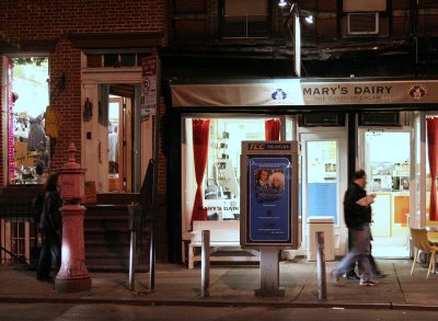
West Village, West 4th Street Between Jones and Barrow Streets
Mary Sargent © 2006 …………….........……………….. click to enlarge
A week ago last Tuesday night (11/14), I went downtown after work to pick up some chocolates at Varsano's, which has THE best chocolate I've ever had. Dark chocolate almond bark, none better. I had a fright when I got there and the store was gone. Gone! I walked up and down the block in disbelief, wondering if I were on the right street. Finally, I went into a bakery and asked about it and was told it had moved across the street. So relieved. But this is a one man operation and it won't go on forever, so I'd advise you to waste no time getting there.
Note: the store is still listed as being at 179 West 4th, but the new address is 172 West 4th, between Cornelia and Jones.
This shot is not Varsano's, of course, and why do I never have a shot of the destination, I wonder. I think it's because I'm too close to it. I stand there and shoot across the street, in this case, at Mary's Dairy, which I haven't tried. I'll try to be more conscious in the future.
See map.
Posted by
Mary Sargent
at
9:15 PM
1 comments
![]()
Labels: 4th Street, Downtown, West Village
Friday, November 24, 2006
Gramercy, 23rd Street Between Lexington Avenue and Park Avenue South

Mary Sargent © 2006 ………….........………………….. click to enlarge
And this, the final shot in my November 14 lunch time walk. Love those horizontals.
See map.
Posted by
Mary Sargent
at
10:21 PM
0
comments
![]()
Labels: 23rd Street, Gramercy, Midtown, Midtown South
Thursday, November 23, 2006
Gramercy, Lexington Avenue Between 22nd and 23rd Streets
Mary Sargent © 2006 ……………………….........…….. click to enlarge
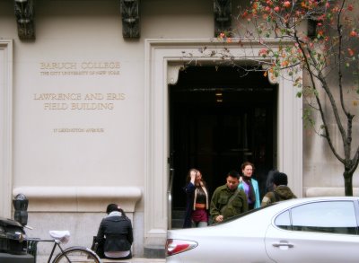
I am so tired from all the tryptophan that it's all I can do to press the button to post this photo. Happy Thanksgiving all.
See map.
Posted by
Mary Sargent
at
9:39 PM
2
comments
![]()
Labels: Gramercy, Lexington Avenue, Midtown, Midtown South, Schools
Wednesday, November 22, 2006
Gramercy, Lexington Avenue Between 22nd and 23rd Streets

Mary Sargent © 2006 ………………….........………….. click to enlarge
I turned the corner at 22nd Street onto Lexington Avenue, looked across the street and immediately thought: Composition in Gray and Black with Red Accent.
Actually, I just made that up. More likely I thought: quick, get that shot.
See map.
Posted by
Mary Sargent
at
7:25 PM
2
comments
![]()
Labels: Gramercy, Lexington Avenue, Midtown, Midtown South
Tuesday, November 21, 2006
Gramercy, 22nd Street Between Park Avenue South and Lexington
Mary Sargent © 2006 …………….........……………….. click to enlarge
I wanted to make fun of School of the Future based on their sign which looks 1930s to me, but I was rebuked by their website which extolls the school. Maybe it is that good. I hope so. The lettering in stone that runs above the arches and looks even older than 1930, more like medieval, reads Manhattan Trade School for Girls. This link is part of a larger site called the Proposed Gramercy Park Historic District Extension, which has information on a number of buildings in the Gramercy area, including the one featured in the last two posts, The Gramercy Arms.
See map.
Posted by
Mary Sargent
at
9:45 PM
0
comments
![]()
Labels: 22nd Street, Gramercy, Midtown, Midtown South, Schools
Gramercy, 22nd Street Between Park Avenue South and Lexington
Mary Sargent © 2006 …………………........………….. click to enlarge
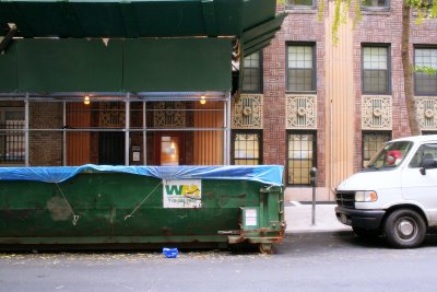
I saw The Barber of Seville tonight and remembered why I like opera. It's late. Have to get up early. Maybe I'll put in a link later.
This is a bit farther (further? No, farther, I'm pretty sure. I'll look it up. Later.) down the block. Note similarities.
See map.
Posted by
Mary Sargent
at
12:33 AM
3
comments
![]()
Labels: 22nd Street, Gramercy, Midtown, Midtown South
Sunday, November 19, 2006
Gramercy, 22nd Street Between Park Avenue South and Lexington

Mary Sargent © 2006 …………………........………….. click to enlarge
I didn't have much time last Tuesday, but I needed some shots, so at lunchtime, I took the subway two stops downtown and took a short walk around the block at 22nd Street.
This is the restaurant Novita, unknown to me until now, but I see it is well regarded by Zagat's, which gives it a 23 for food. The day was warm enough to put the tables out, but not warm enough to actually sit at them.
See map.
Posted by
Mary Sargent
at
7:21 PM
0
comments
![]()
Labels: 22nd Street, Gramercy, Midtown, Midtown South, Restaurants
Saturday, November 18, 2006
Theater District, Eighth Avenue at 42nd Street

Mary Sargent © 2006 ……………………….........…….. click to enlarge
And now at 42nd Street and the last photo of this walk of 2 weeks ago. This is the bottom western corner of the theater district.
See map.
Posted by
Mary Sargent
at
10:46 PM
2
comments
![]()
Labels: Eighth Avenue, Midtown, Theater District
Friday, November 17, 2006
Theater District, Eighth Avenue Between 43th and 42nd Streets

Mary Sargent © 2006 ………. click to enlarge
Sometimes I feel like the rawest tourist. Is this building believable? Doesn't it look like a graphic design? Why haven't I heard about it? I have the feeling everyone knows about it but me.
Looking at this, you know you're in the theater district.
See map.
Posted by
Mary Sargent
at
8:32 PM
3
comments
![]()
Labels: Color, Eighth Avenue, Midtown, rooftops, Theater District
Thursday, November 16, 2006
Theater District, Eighth Avenue Between 46th and 45th Streets
Mary Sargent © 2006 ……………………….........…….. click to enlarge
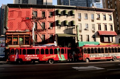
Same walk of November 4; I've just crossed into another neighborhood, turning onto Eighth Avenue and walking downtown to 42nd Street to get the subway home.
There're two ways these old buildings, only 4 stories high, still stand. One way is when it's squeezed between tall, tall newer buildings and the other is this way, standing all by itself, isolated. Well, there are more than two ways, but these two ways seem especially poignant to me. I hope I'm not identifying with old buildings.
See map.
Posted by
Mary Sargent
at
9:44 PM
2
comments
![]()
Labels: Color, Eighth Avenue, Midtown, Stand Alone Buildings, Theater District
Wednesday, November 15, 2006
Hell's Kitchen, 46th Street Between Ninth and Eighth Avenues
Mary Sargent © 2006 ……………………........……….. click to enlarge
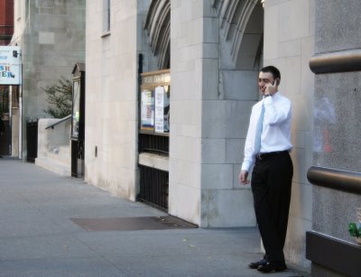
Same block. Can't resist. Something about this guy makes me happy.
See map.
Posted by
Mary Sargent
at
11:01 PM
1 comments
![]()
Labels: 46th Street, Hell's Kitchen, Midtown, Midtown West
Tuesday, November 14, 2006
Hell's Kitchen, 46th Street Between Ninth and Eighth Avenues

Mary Sargent © 2006 ………………….......………….. click to enlarge
Now we're back into civilization. You can tell because here there be restaurants. In fact, this block is called Restaurant Row, and I'm sorry I can't tell you how many restaurants on it, but I didn't think of counting them at the time. A lot of pre-theater business.
See map.
Posted by
Mary Sargent
at
9:03 PM
5
comments
![]()
Labels: 46th Street, Color, Hell's Kitchen, Midtown, Midtown West
Monday, November 13, 2006
Hell's Kitchen, 45th Street Between Eleventh and Tenth Avenues

Mary Sargent © 2006 ……………………….........…….. click to enlarge
I've been thinking about which word is more evocative: sunlight or sunshine. I think sunlight. Today is a rainy November day, yesterday was a rainy November day and tomorrow it will rain again, and I'm looking at this photograph taken nine days ago and thinking how sunlight can make a dirty white plastic fence something pleasing to look at.
See map.
Posted by
Mary Sargent
at
9:40 PM
1 comments
![]()
Labels: 45th Street, Hell's Kitchen, Midtown, Midtown West
Sunday, November 12, 2006
Hell's Kitchen, 45th Street Between Twelfth and Eleventh Avenues
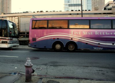
Mary Sargent © 2006 …………………………….. click to enlarge
Now walking back east. This is last Saturday, Nov. 4.
It's the fire plug.
By the way, for those of you who live in New York, don't miss the Brice Marden exhibit at MOMA. I was converted last night. He had just sort of annoyed me before, in a vague, uninformed way, but now I forgive him whatever it was because, damn, some beautiful stuff there. Especially the drawings. Here's a link to some images, but you won't know what it's all about unless you see the real thing.
See map.
Posted by
Mary Sargent
at
7:57 PM
4
comments
![]()
Labels: 45th Street, Hell's Kitchen, Midtown, Midtown West
Saturday, November 11, 2006
Hell's Kitchen, 46th Street Between Eleventh and Twelfth Avenues

Mary Sargent © 2006 …………………………… click to enlarge
This is the last block of 46th Street before the West Side Highway and the Hudson River. It's an unusually active block for being out here on the edge – there's a construction site where they're probably putting up billion dollar apartments because, of course, what rich person wouldn't want to live in this adorably gritty neighborhood? And on the corner, there's an H&H Bagel plant and retail store, which I'm not going to show you because we don't have time, and the photo wasn't that good, but there's a photograph on their website if you are obsessive, which I sincerely hope you are. I wish I had been hungry.
See map
Posted by
Mary Sargent
at
11:29 PM
1 comments
![]()
Labels: 46th Street, Hell's Kitchen, Midtown, Midtown West
Friday, November 10, 2006
Hell's Kitchen, 46th Street Between Tenth and Eleventh Avenues

Mary Sargent © 2006 ………………………… click to enlarge
I look up a lot more than I used to. The great thing about doing this is you can do anything you damn please, you can look up, over, stare, gawk, study your map, and it doesn't matter what people think, whether they think you're a tourist or just dimwitted, because you know better, you know you're a Street Photographer. Yeah.
See map
Posted by
Mary Sargent
at
6:38 PM
2
comments
![]()
Labels: 46th Street, Hell's Kitchen, Midtown, Midtown West, rooftops
Thursday, November 09, 2006
Hell's Kitchen, 46th Street Between Tenth and Eleventh Avenues

Mary Sargent © 2006 …………………………. click to enlarge
This is a perfect photograph.
Yes, it is.
See map.
Posted by
Mary Sargent
at
10:51 PM
2
comments
![]()
Labels: 46th Street, Hell's Kitchen, Midtown, Midtown West, Perfect
Wednesday, November 08, 2006
Hell's Kitchen, 46th Street Between Ninth and Tenth Avenues
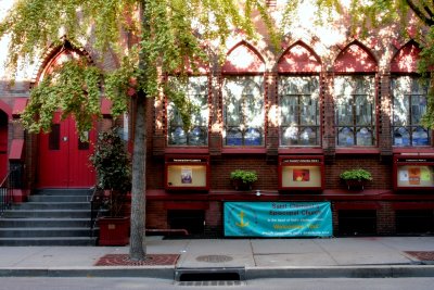
Mary Sargent © 2006 …………………………… click to enlarge
Last Saturday I went to get a haircut at David Ryan's on West 46th Street. See map. If I were on top of things, I'd have a link to a photo of my haircut. Not on top of things. Afterwards I walked 46th Street to the river and back on 45th Street.
This is a pretty and frothy shot that reminds me in its prettiness and frothiness of this Cornelia Street shot last summer.
Posted by
Mary Sargent
at
7:53 PM
5
comments
![]()
Labels: 46th Street, Churches Synagogues Mosques, Hell's Kitchen, Midtown, Midtown West
Tuesday, November 07, 2006
West Village, Seventh Avenue South at Morton Street

Mary Sargent © 2006 ……………………………click to enlarge
QUICK! What color is New York? Did you think taxi cab yellow?
Morton is the street before Leroy, my destination, and I will leave you here to go back to watching election returns. Hoping, hoping, being afraid. Because I've been hurt in the past.
Posted by
Mary Sargent
at
8:02 PM
3
comments
![]()
Labels: Downtown, Seventh Avenue South, West Village
Monday, November 06, 2006
West Village, Seventh Avenue South at Bleecker Street
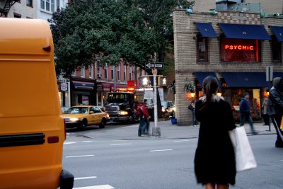
Mary Sargent © 2006 …………………………… click to enlarge
A few years ago, I was thinking of doing a photo series of psychic parlors. They seemed archaic to me, out of time, and I couldn't imagine how so many of them managed to pay their rent, but they were everywhere, and in all kinds of neighborhoods. So I took some photos, but never did the series. Because –
Well, two things. The main thing was that most of the photographs were not that interesting. Second, as the world turns more and more fundamentalist and anti-science, they don't seem that remarkable anymore. Just a sign of the times. Hello, Dark Ages.
Note: the guy in the far right of the photo is the guy from last night's post, making his way down Seventh Avenue South.
Posted by
Mary Sargent
at
7:16 PM
3
comments
![]()
Labels: Downtown, Psychic, Seventh Avenue South, West Village
Sunday, November 05, 2006
West Village, Barrow Street Between West 4th and Seventh Avenue South
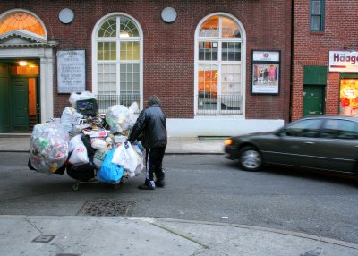
Mary Sargent © 2006 ………………………… click to enlarge
The West Village is part of Greenwich Village, from Sixth Avenue to the Hudson River, the other borders being 14th Street and Houston Street. Greenwich Village, in addition to the West Village, includes the area to the east, to "roughly" Broadway, according to Wikipedia. In the West Village are the old winding, confusing streets, which were in existence from the beginning, long before the Commissioners' Plan of 1811 created the street grid. See map.
I notice, looking at the map, that it doesn't look THAT confusing. If you haven't been there, you'll have to take my word for it. If you have, you know. The rest of Greenwich Village, Sixth Avenue to Broadway. does conform to the grid and seems more stately and less Village like.
By the way, one problem with using MapQuest as a reference is that it appears to position the maps according to some crazy concept of true north. All New Yorkers know that the avenues run north-south and the streets run east-west regardless of this so-called true north. Try to disregard the slant.
Posted by
Mary Sargent
at
8:20 PM
4
comments
![]()
Labels: Barrow Street, Downtown, West Village
West Village, Seventh Avenue South at Bleecker Street

Mary Sargent © 2006 …………………………….. click to enlarge
Still playing catchup, so here is an extra morning shot.
And this is still a week ago Friday. After work I went downtown to have dinner with a friend who lives on Leroy Street in the Village. She has a tiny place, but it has a working fireplace. And what a location!
I walked down from the Christopher Street subway station because I wanted to walk a piece of Seventh Avenue at that spot. It was still Daylight Savings Time, so it was just dusk when I got out of the station around 5:30.
See map.
Posted by
Mary Sargent
at
11:00 AM
2
comments
![]()
Labels: Downtown, Seventh Avenue South, West Village
Saturday, November 04, 2006
Murray Hill, 28th Street Between Third and Lexington Avenues

Mary Sargent © 2006 …………………………….. click to enlarge
This is the last shot from my lunchtime walk a week ago Friday, ending in a crescendo of color and complexity. Very different from the beginning.
After shooting this scene for a few minutes, I was stimulated enough that I could face going back to my beige office with the metal filing cabinets.
See map.
Posted by
Mary Sargent
at
7:58 PM
3
comments
![]()
Labels: 28th Street, Color, Midtown, Murray Hill
Murray Hill, Third Avenue at 28th Street

Mary Sargent © 2006 …………………………….. click to enlarge
Extra post, Saturday morning. I need to catch up.
This is still a week ago Friday, I'm walking back to the office from my lunch time walk.
Posted by
Mary Sargent
at
9:04 AM
0
comments
![]()
Labels: Midtown, Murray Hill, Third Avenue
Friday, November 03, 2006
Murray Hill, 28th Street Between Second and Third Avenues

Mary Sargent © 2006 …………………………….. click to enlarge
I've decided to use more categories (neighborhoods) rather than fewer, so here, making its first appearance, is Murray Hill. Wikipedia says the boundaries are from 42nd to 29th Streets and Fifth to Second Avenues, and The New York Times in 1982 "loosely defined" it as having borders at 42nd and 34th Streets and Madison Avenue and the East River. Combining the two, I'm calling it Murray Hill if it's south of 42nd Street, west of Second Avenue, north of 29th Street and east of Madison Avenue. I'm going to have to change some titles.
So this is Murray Hill last Friday, a cold, bleak day, not as cold as this Friday, but bleaker. I love this building, at least photographically speaking. I can't tell you how much time I spent trying to decide which shot, of the many I took here, to show you. They're all similar, but there's enough difference between them to make me vacillate. I hope this is the right one. Be sure to notice the window coverings.
Posted by
Mary Sargent
at
7:55 PM
2
comments
![]()
Labels: 28th Street, Midtown, Murray Hill
Thursday, November 02, 2006
Kips Bay, First Avenue at Pedestrian Way (27th Street)
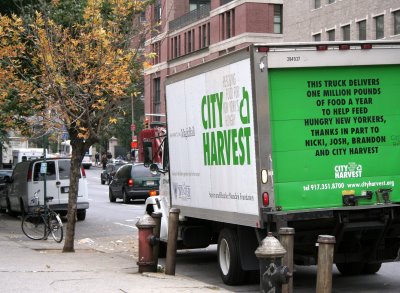
Mary Sargent © 2006 …………………………….. click to enlarge
A cheering sight on this chill autumnal day, the bright green truck that feeds hungry New Yorkers. I keep thinking I should donate to this charity and now I'll take a public vow to do so. There, I just did. And you can, too. For those who don't know, City Harvest collects food from restuarants and other food establishments that would otherwise be discarded and distributes it to people who need it.
I swear, when I took this photo, and when I selected it, I was just looking at colors and shapes.
Posted by
Mary Sargent
at
8:30 PM
1 comments
![]()
Labels: First Avenue, Kips Bay, Midtown, Midtown East
Wednesday, November 01, 2006
Kips Bay, Mount Carmel Place Between 26th and 27th Streets

Mary Sargent © 2006 …………………………click to enlarge
And now it's last Friday and a very different kind of day. Cloudy, cold and bleak, like mid November.
I was excited to visit this street – on my map, it's called A New Street. See Mapquest map, to see where we are. I'd guess my map is about ten or twelve years old. I used two maps before this one and they both fell apart, which is why I had the third one dry mounted. The second one is the only one I dated: September 27, 1991, so the one I'm using now is not as old as that.
So I arrive to find the street is named Mount Carmel Place. A puzzle. It runs two blocks between First and Second Avenues.
If you check the map, you'll see what looks like a continuation of 27th Street on the other side of a little park, and in real life it has its street sign, but my map calls it Pedestrian Way, and indeed it is a pedestrian walkway. It is not a street.
Anyway, if you're still with me, isn't this a nice street? (You won't agree unless you enlarge.)
Forgotten New York has a photo and paragraph on this street, page down to see it. His photograph looks north, whereas mine looks south.
Posted by
Mary Sargent
at
10:27 PM
1 comments
![]()
Labels: Kips Bay, Midtown, Midtown East, Mt. Carmel Place


